Mapping the Alone Australia Season 3 Contestants
In this post, I walk through how I used aerial imagery and terrain analysis to pinpoint where each contestant was dropped in Alone Australia — despite the show’s misleading infographics.
Spoiler: “6.2km away” can actually mean just 670 metres
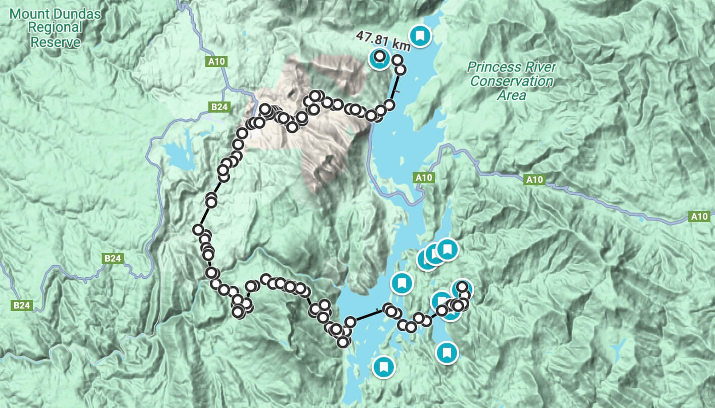
But first, here’s a map of Lake Burbury (Wikipedia) (Google Maps) showing where each contestant was dropped. Get exploring now!
- Hit the Fullscreen icon in the map below to fully explore
- Try out the Aerial Photography layer
- Try out the hillshade layer to see how rising water levels may have effected each location differently
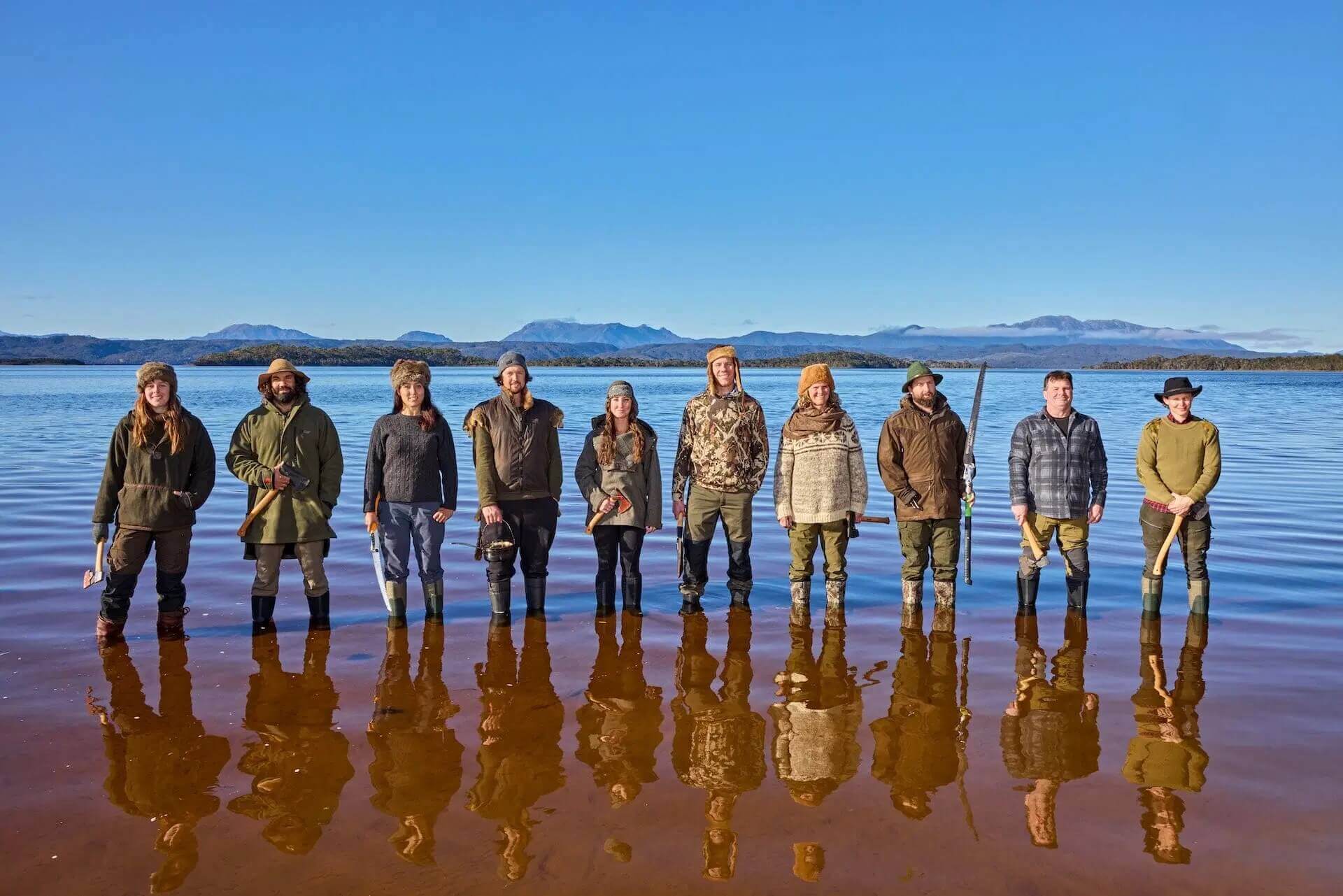
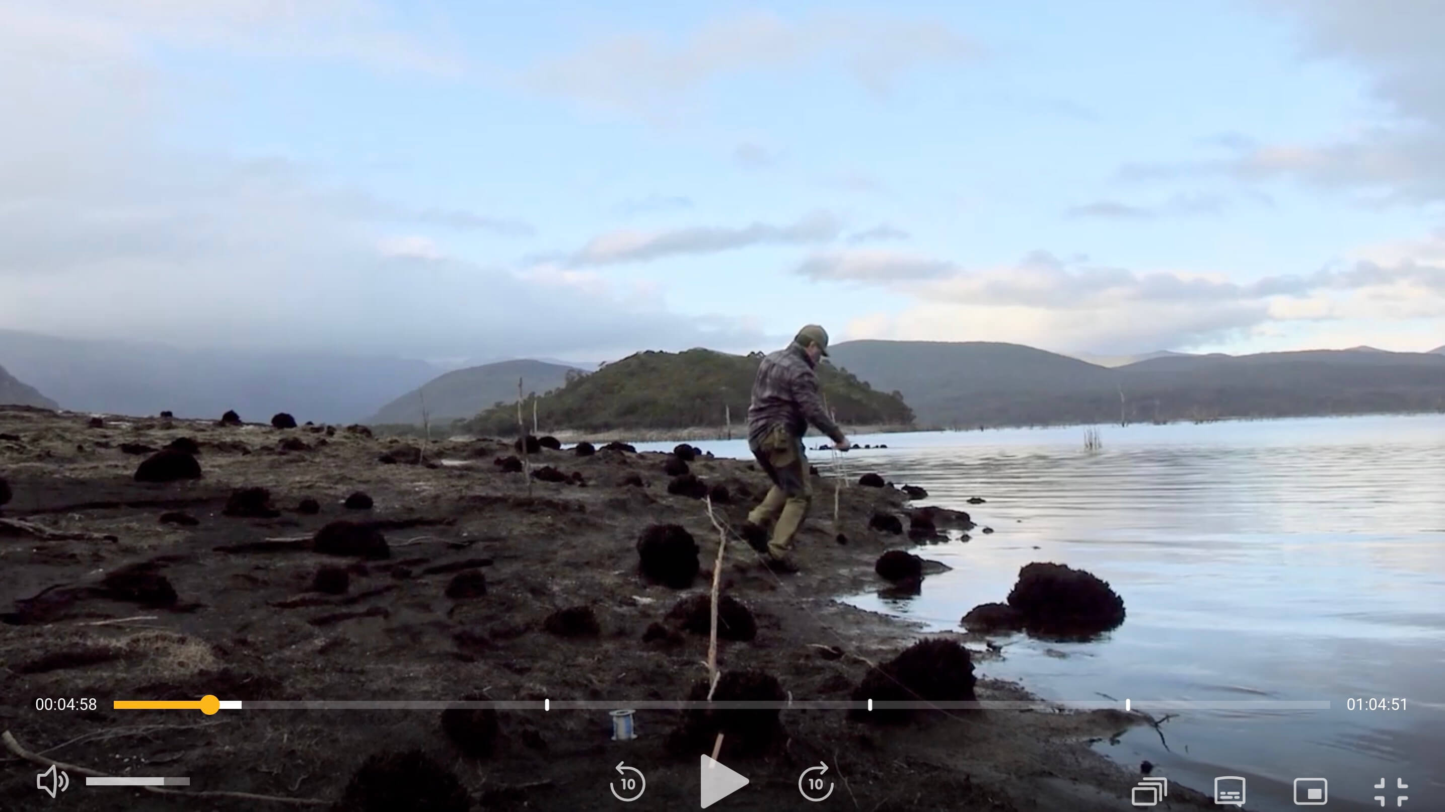
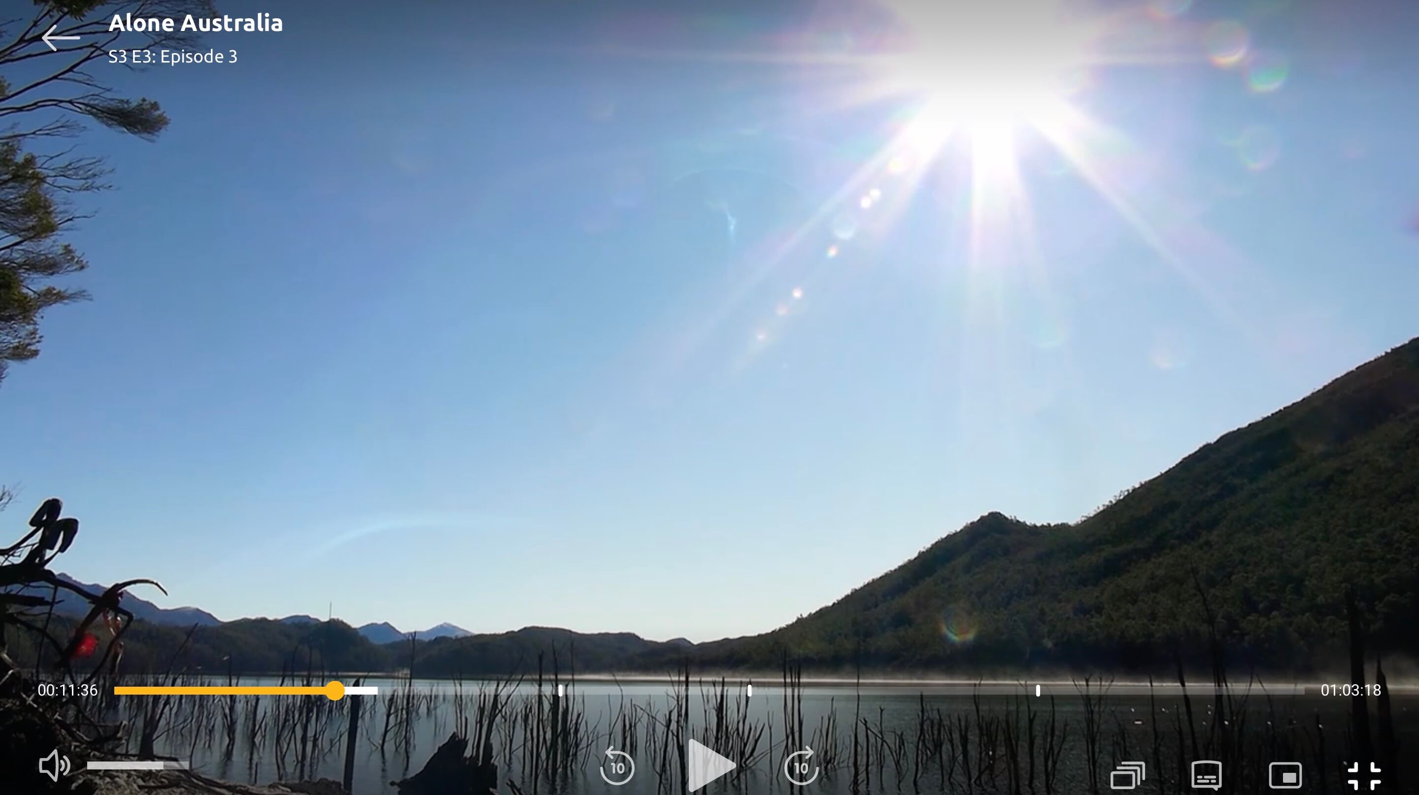
It all started when I saw this photo of the Alone contestants
The mountain range in the background looked so familiar. I was sure I’d seen that view before — but where?
So, on my lunch break, I fired up the map apps and started scanning around. But it was actually one of my workmates, Stuart, who beat me to it and found the spot almost immediately.
Then I found this photo I took in 2021 from almost the same location — with the exact same mountain silhouette in the background.
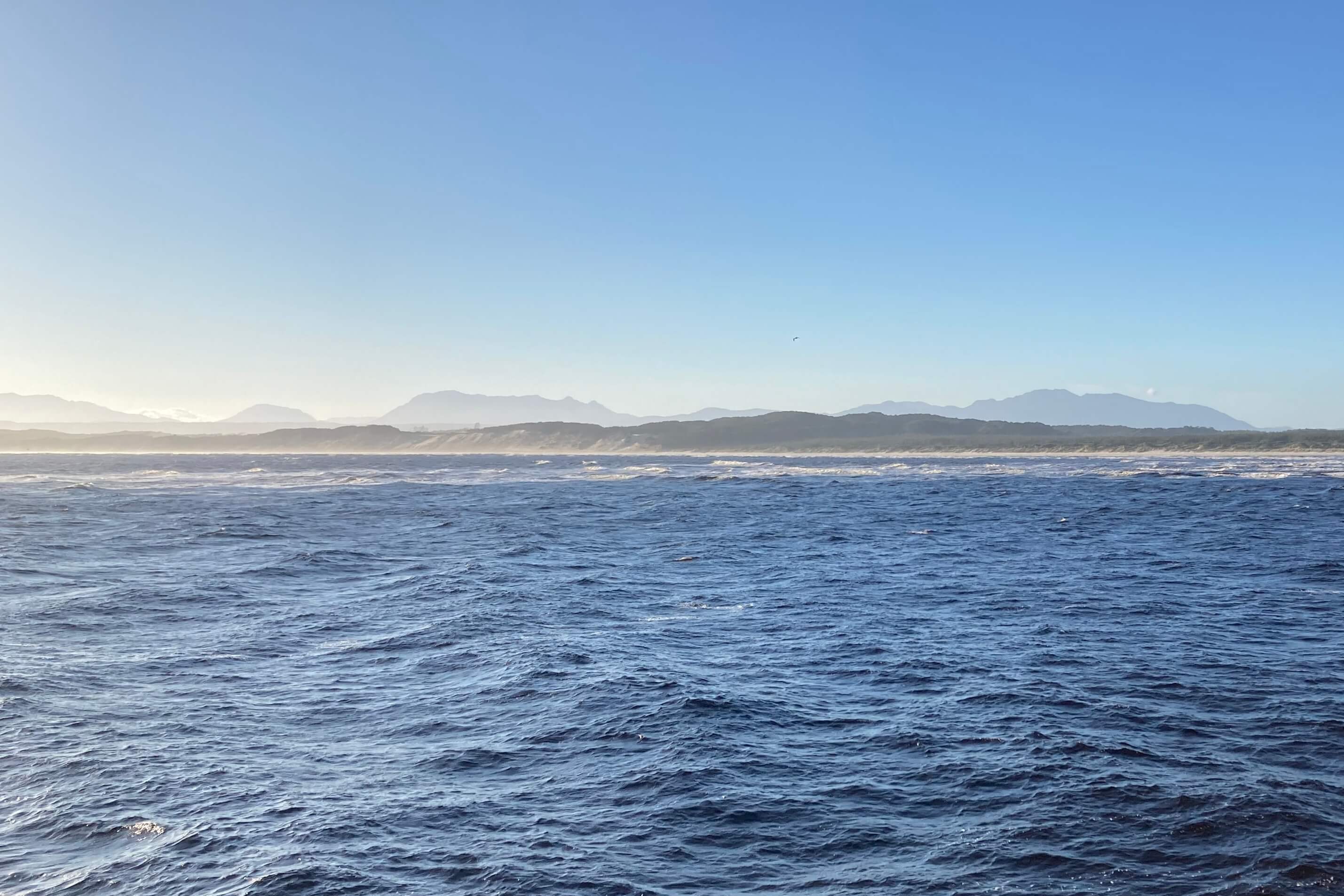
It was pretty exciting to find how closely my own photo matched the promo photo.
From there it didn’t take long — by the end of the first episode I knew I had to try and find the exact drop locations for every contestant.
But, would this even be possible?

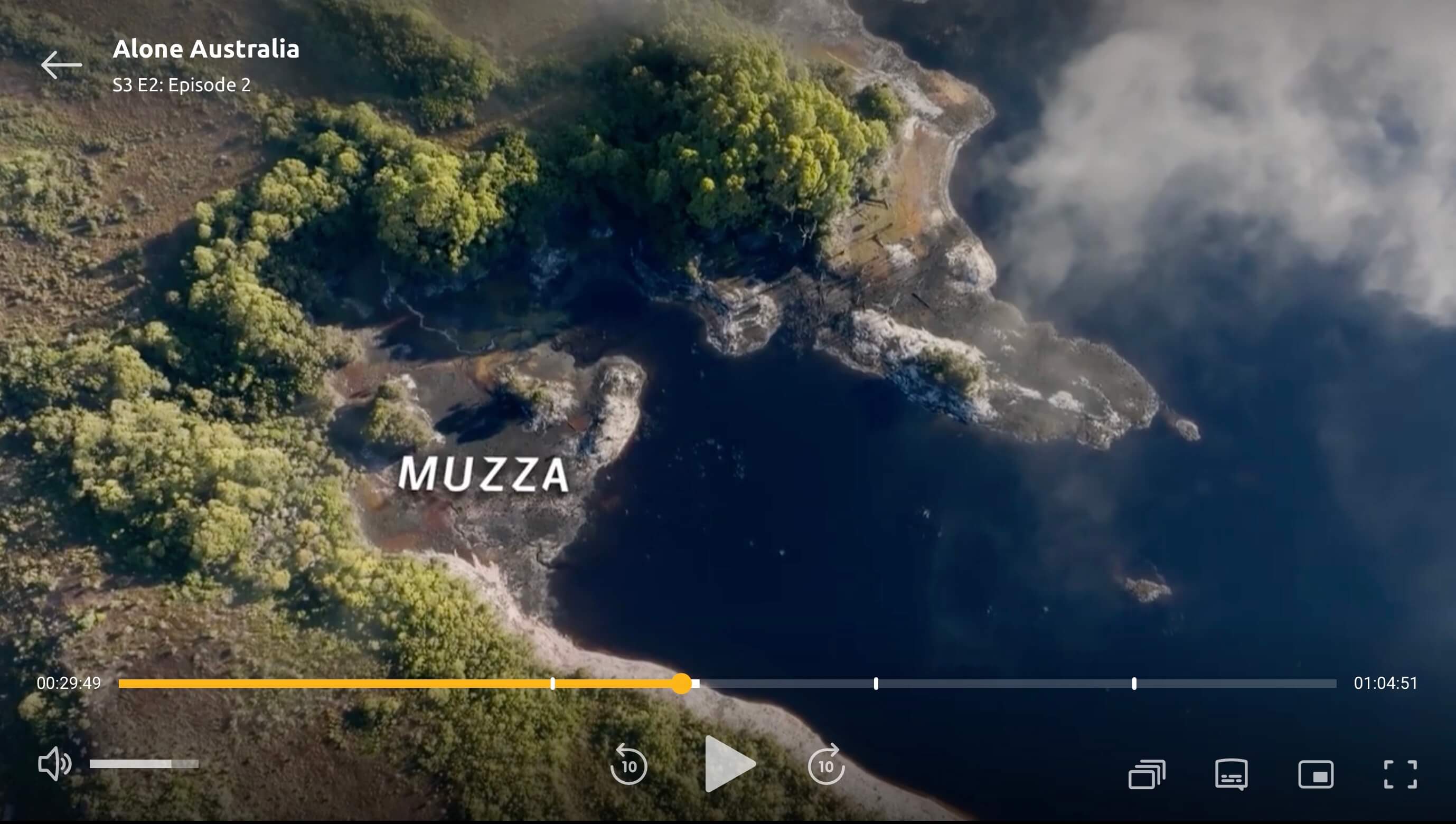
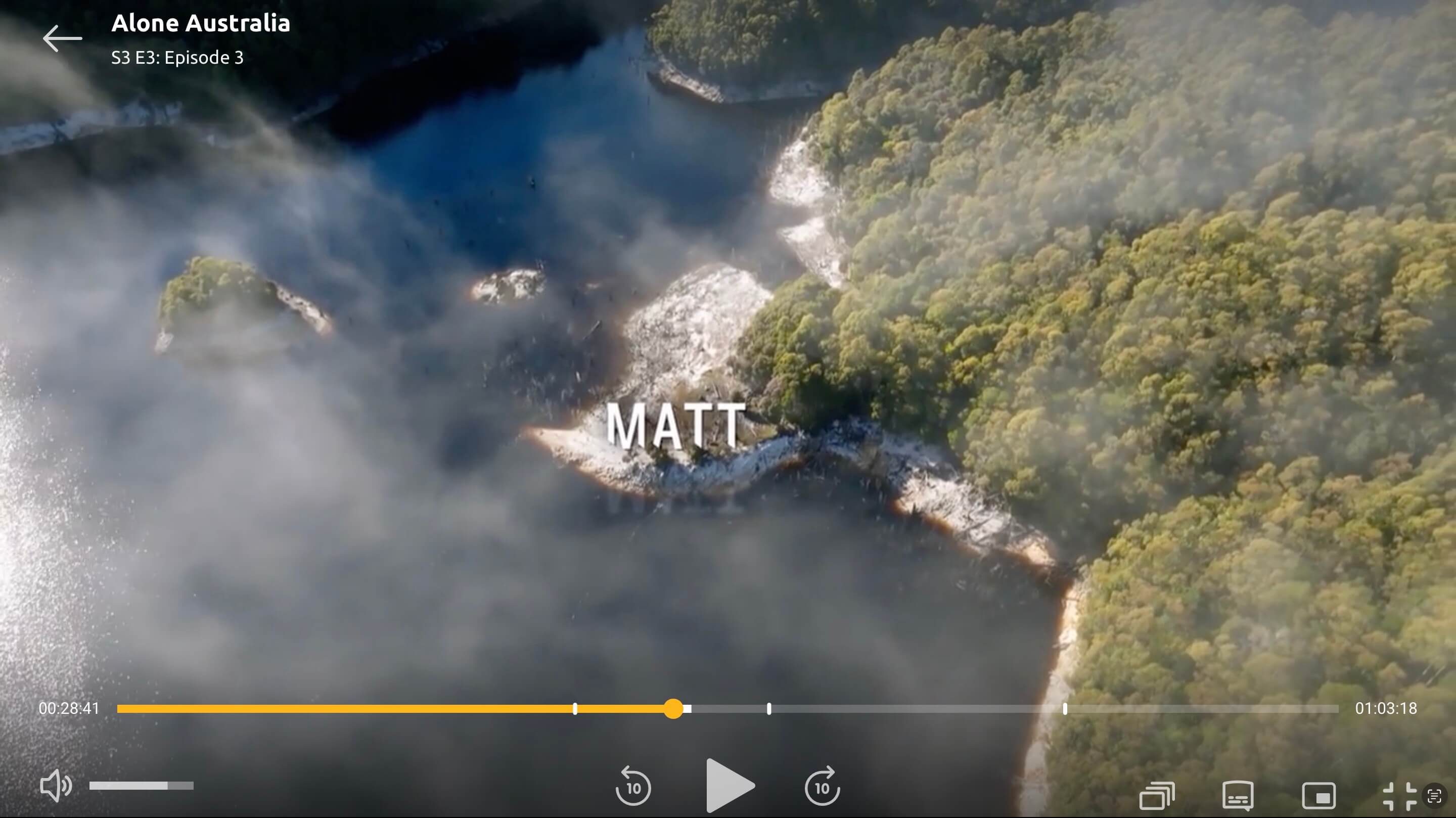
Step 1: Find Muzza
If I was going to find anyone, it’d be Muzza.
Of all the contestants, his drop site had the most identifiable features:
- A wide lake, several kilometres across
- A huge mountain rising at least 500 metres above the water
- The lake extended east and north (judging by the sun)
- A medium-sized island visible in many shots
As SBS’s had promoted the season being filmed within the West Coast Ranges of Tasmania, it didn’t take long to scan satellite images and topographic maps and narrow Muzza’s location down: the lake was almost certainly Lake Burbury, and the mountain was probably Mount Lyell.
I started dropping into 3D views in Google Earth, rotating the camera to match the angles from my screengrabs. It didn’t take long to find a match and confirm it was Mount Lyell. When I spotted the island that kept showing up in the background of Muzza’s footage, I knew I’d locked in the area — within about 500 metres.
But how close could I get?
I was convinced I should be able to match the shoreline in the show exactly to what I saw in Google Maps.
But the water levels threw me off. None of the shoreline matched what I saw on screen.
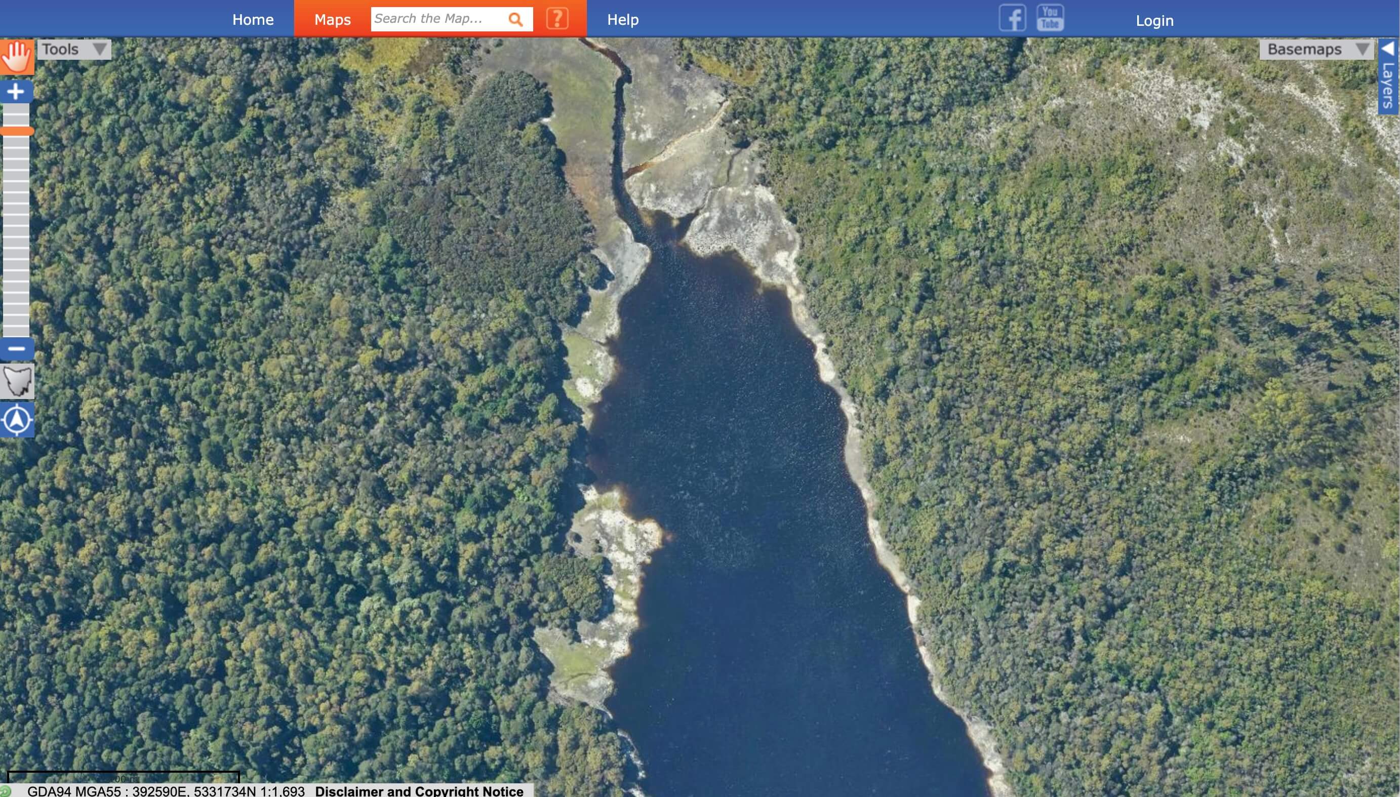
Eventually, it clicked: Google’s satellite imagery was taken when the water level was high — but the early episodes had clearly been filmed during much lower levels.
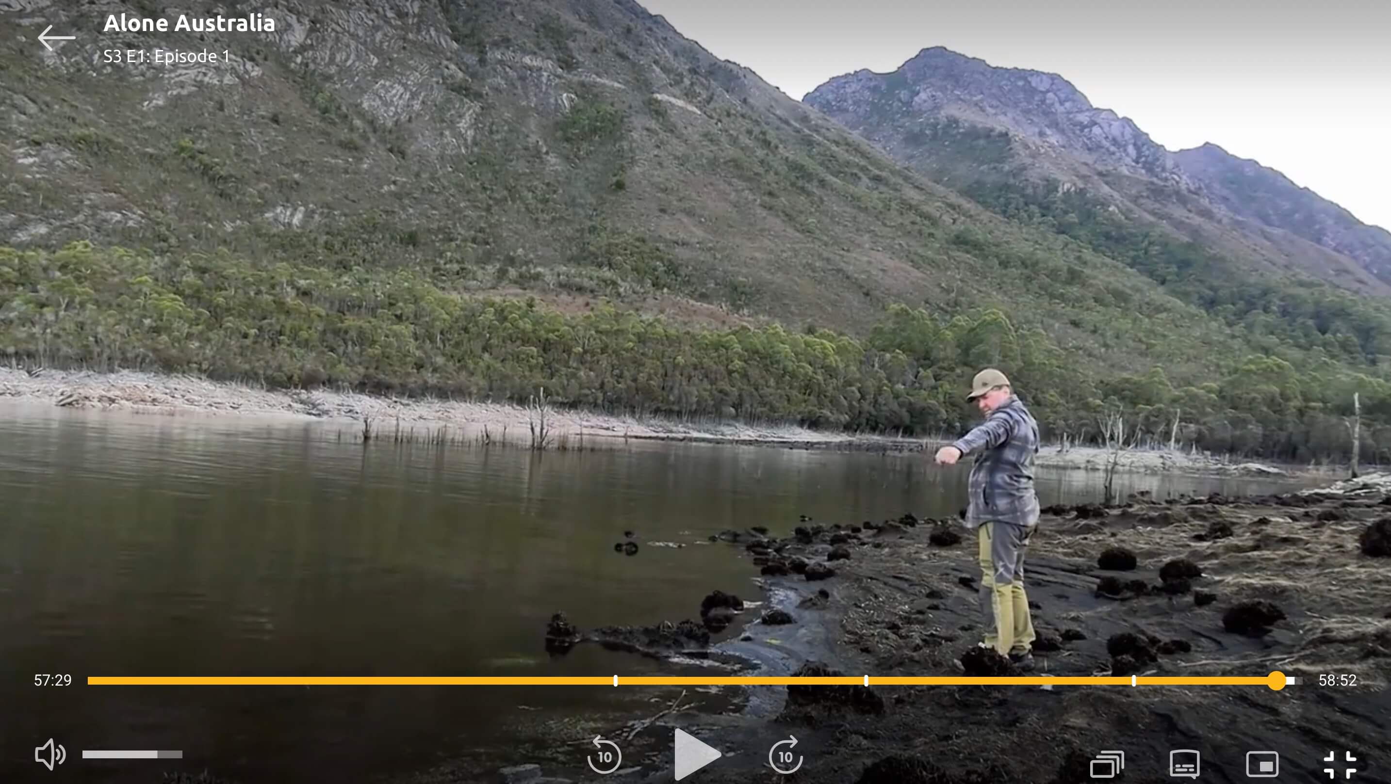
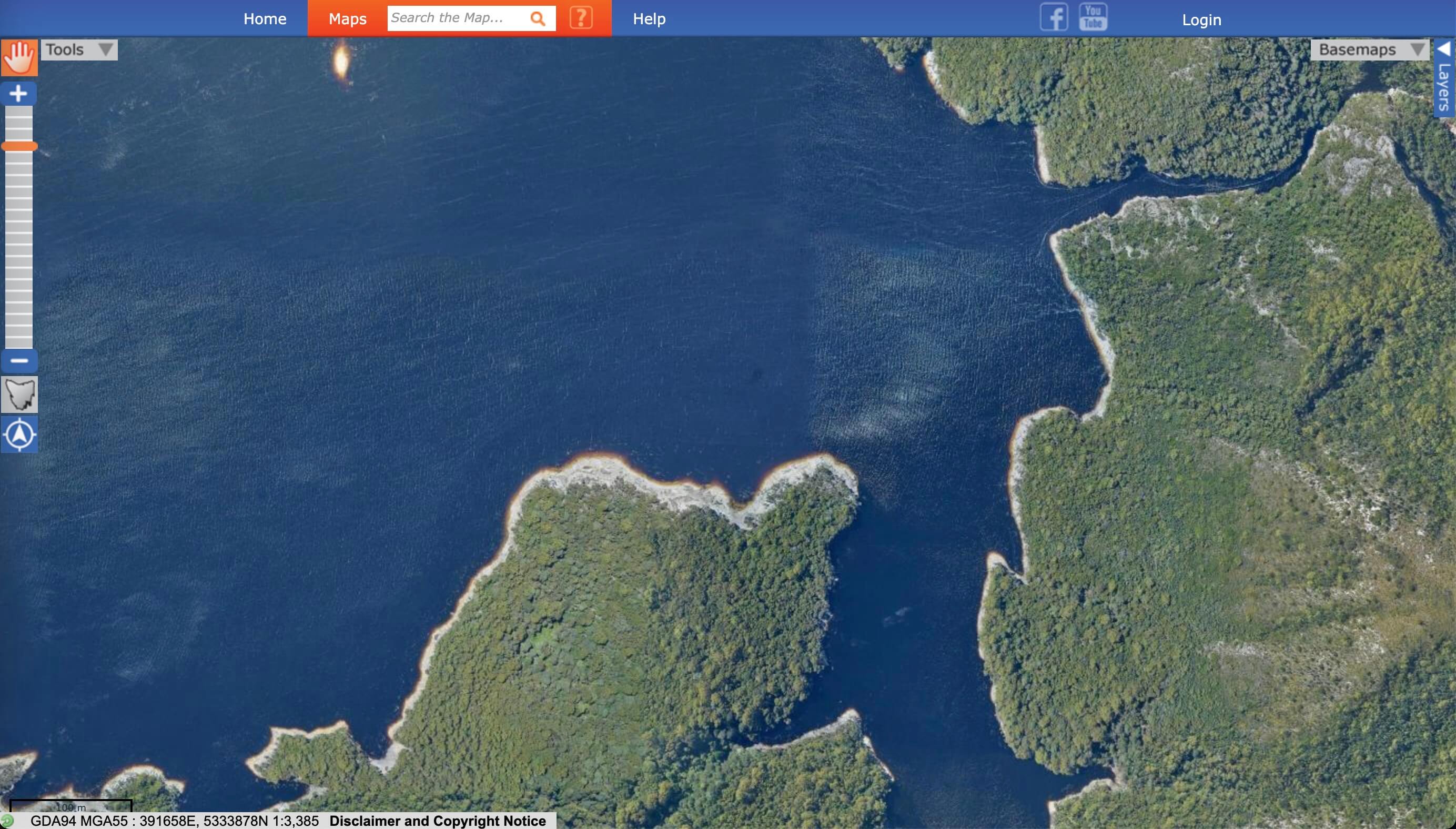
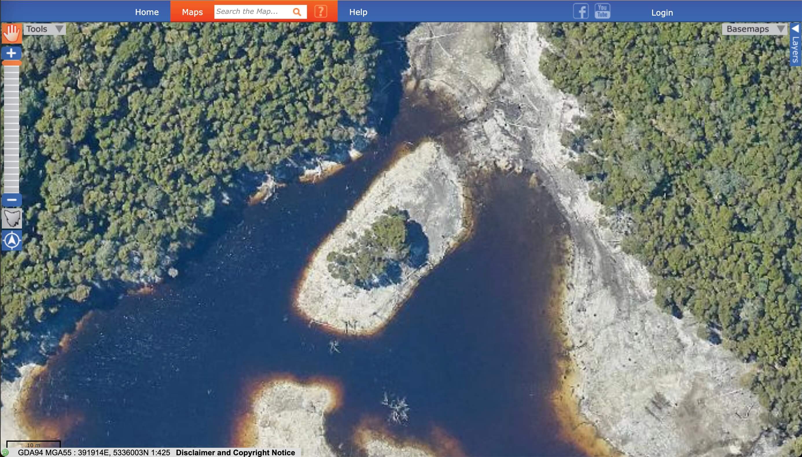
So I switched to the high-resolution aerial imagery from The LISTMap — a Tasmanian government resource. With better detail and the right water level, I was finally able to pinpoint Muzza’s exact drop location.
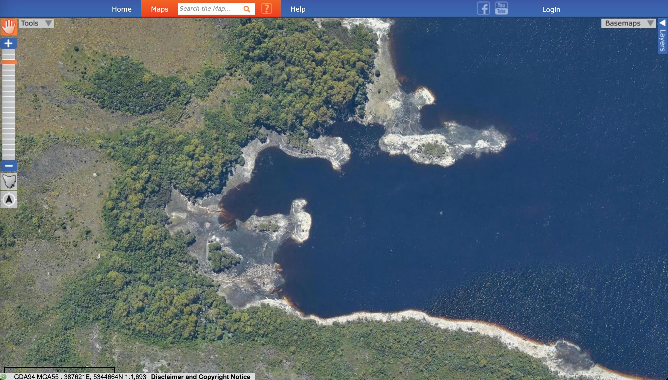
Water levels close to, but a smidge higher, than start of season 3.
Now I was convinced the rest would be easy
Apart from Shay, most of the other contestants were dropped in areas without obvious landmarks. There was usually just enough detail that I could probably pinpoint their campsites — if I had a rough idea of where to look.
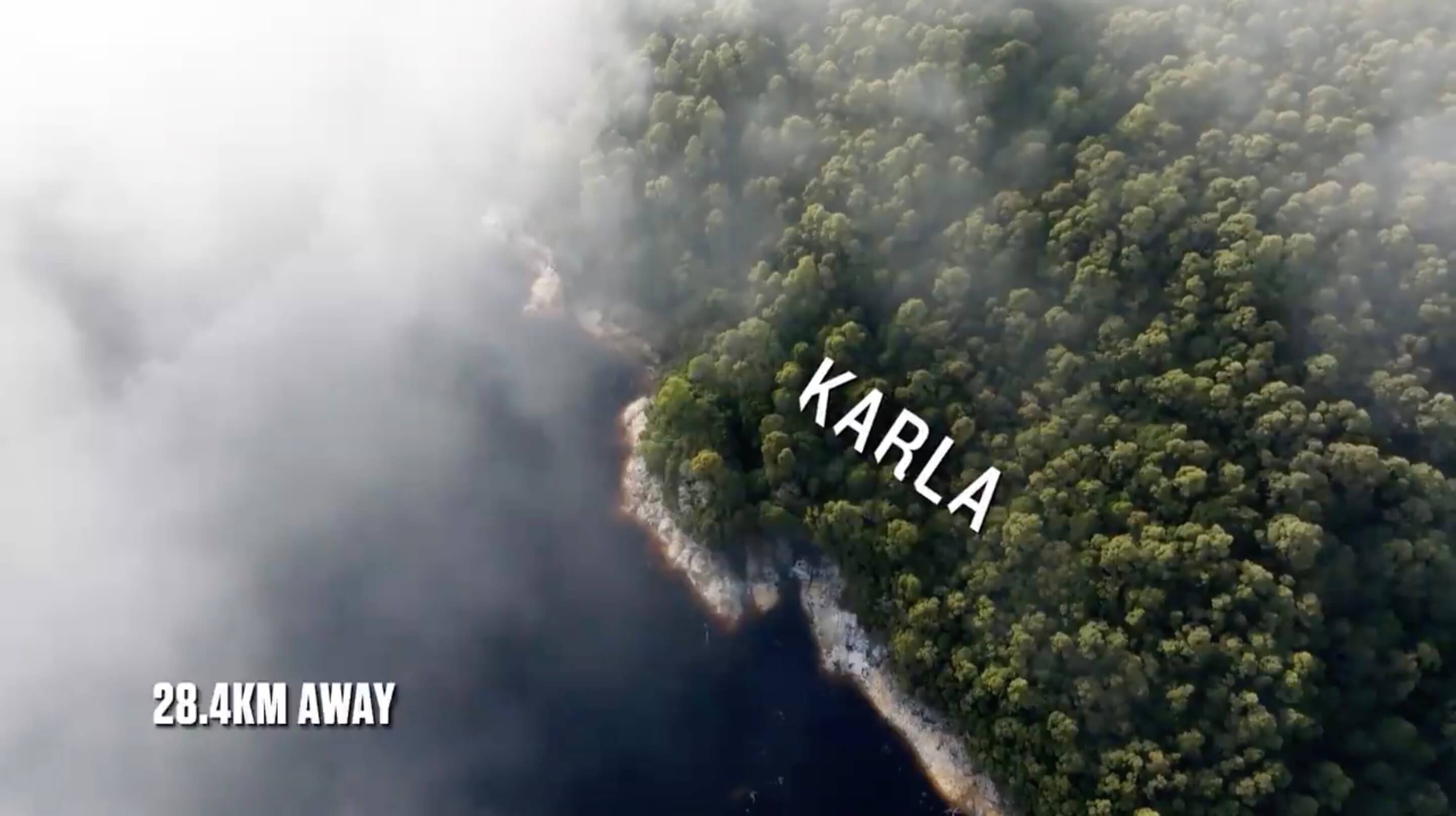
That’s where the show’s distance infographics came in. The producers often flash up markers like “49.7 km away”, showing how far one contestant is from another. I figured I could use those.
  Muzza → Ben:     32.4 km
  Muzza → Ceilidh: 49.7 km
  Muzza → Karla:   28.4 km
  Muzza → Matt:    51.4 km
  Muzza → Tom:     46.1 km
So, whenever a distance to Muzza was shown, I logged it. Then I used Google Maps’ measure tool to draw circles around his confirmed location — and started scanning shorelines where those circles intersected lake shores.
It felt like a solid strategy.
But it never occurred to me that those distances might not be accurate.
That assumption sent me down a long — and completely unhelpful — rabbit hole.
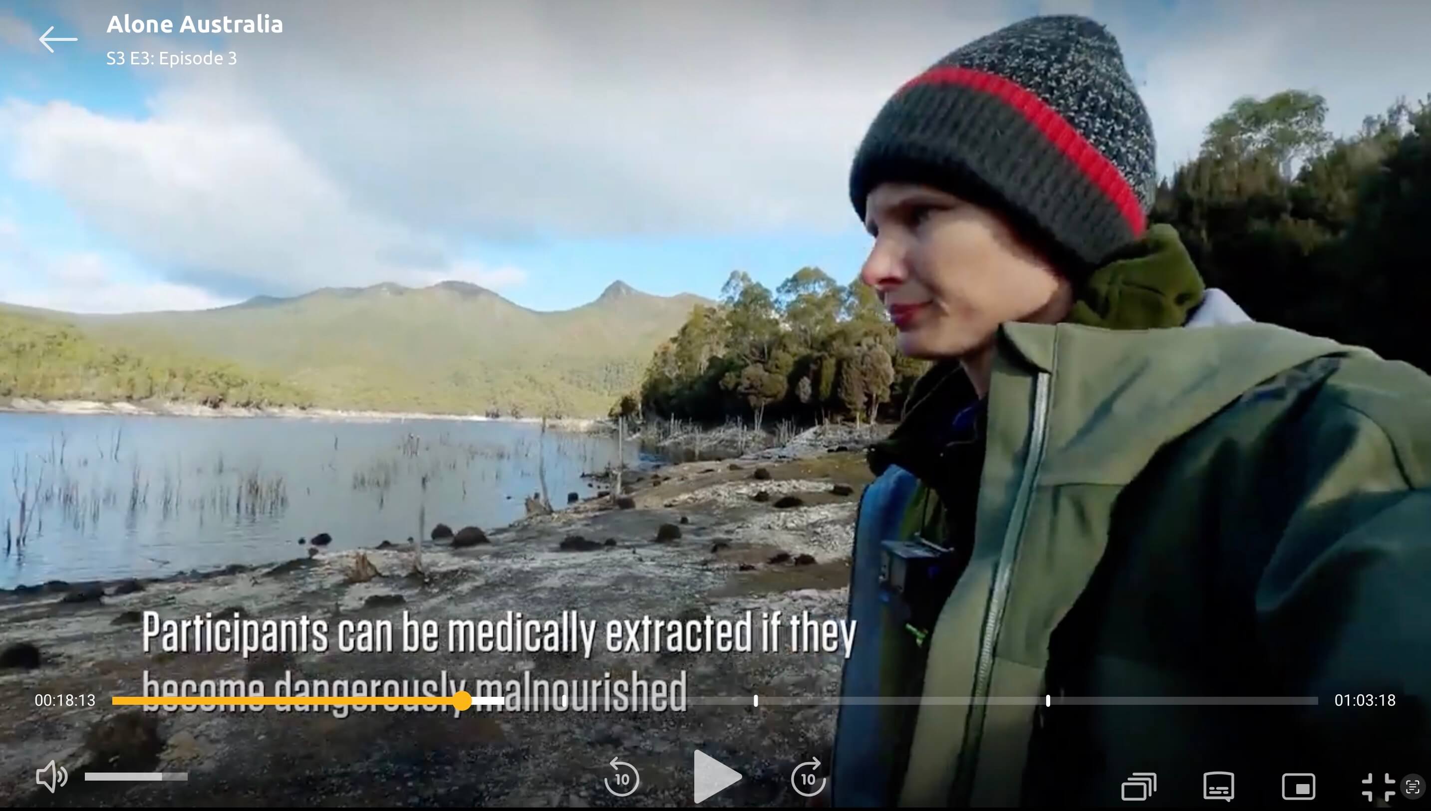
The Problem with Precision
There’s a mathematical principle that says:
Only show as much precision as you actually measured.
If I say it’s 20,000 km from Sydney to London, you get the rough idea — give or take five thousand. But if I say 16,989.5 km, you’d rightly assume I measured it precisely — probably down to a few hundred metres.
That’s the issue with the infographics in season 3. When the show says “7.4 km away”, you assume they mean exactly 7.4 km.
That’s what I assumed too. And it’s why I believed those distances were the key to locating the rest of the contestants.
So, when the show said Muzza and Tom were 46.1 km apart, I used the measure tool to start tracing that distance in all directions — looking for a shoreline that matched.
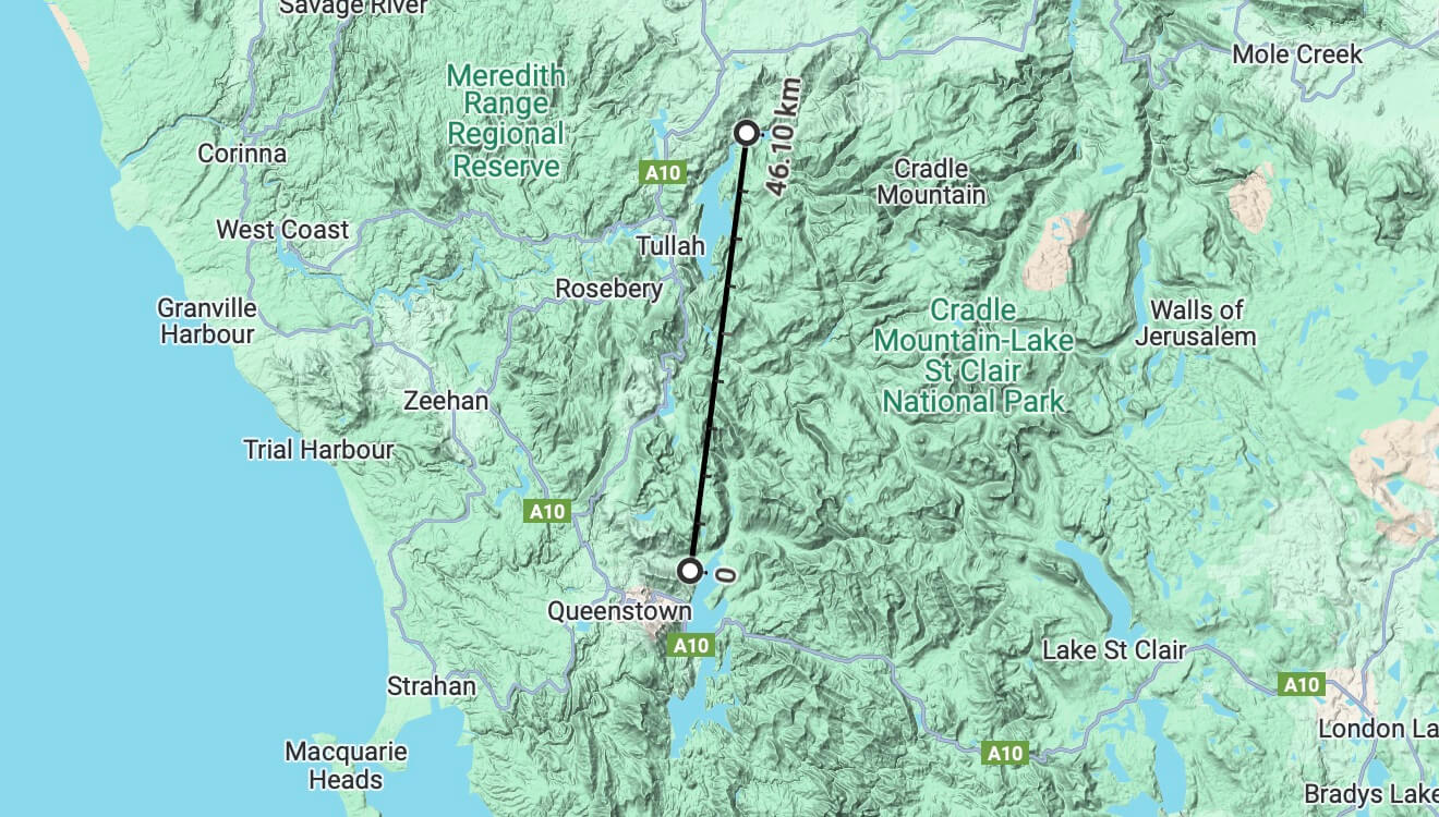
46 km is a long way — far enough to reach across much of western Tasmania. And since the show promoted Season 3 as being set in the West Coast Ranges, I assumed they had contestants spread across multiple lakes.
Spoiler: they hadn’t.
Wasting Time with Lake Mackintosh
Following the 46.1 km trace from Muzza’s location, only one major lake in the West Coast Ranges lined up — the northern end of Lake Mackintosh.
So I dove in. I started scanning the shorelines, combing through every topological map, satellite photo, and scrap of aerial imagery I could find.
And honestly? It felt promising.
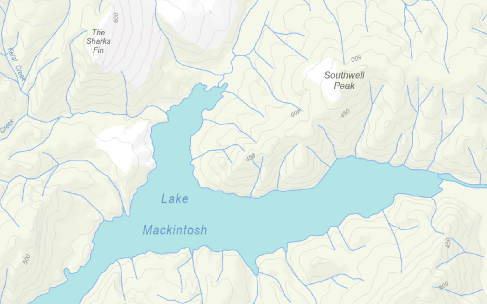
A bunch of spots had the right vibe — inlets, forest lines, mountain ridges that looked close to my screengrabs from Tom and Ceilidh’s footage.
But nothing ever fully matched. There just wasn’t an exact match.
I kept trying, convinced that the distance data would eventually pay off. I even tried placing other contestants using the same logic — but again, nothing lined up.
After hours of searching the shoreline and getting nowhere, I was ready to give up on the whole thing.

Finding Ceilidh
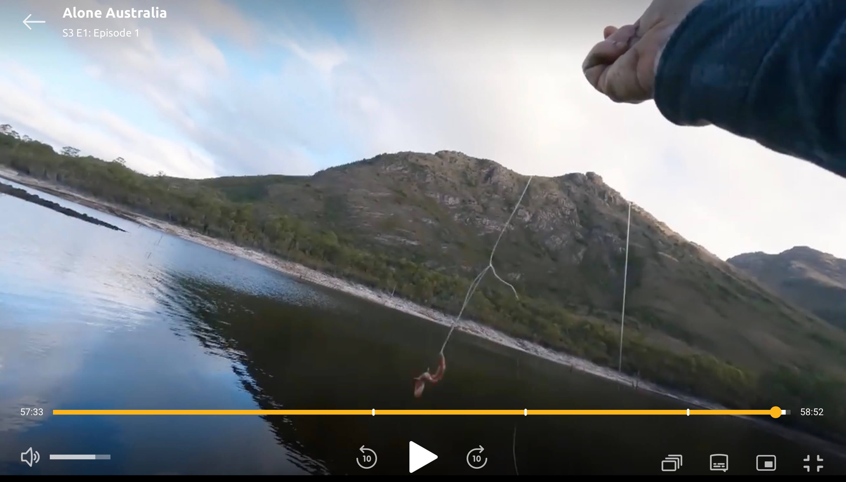
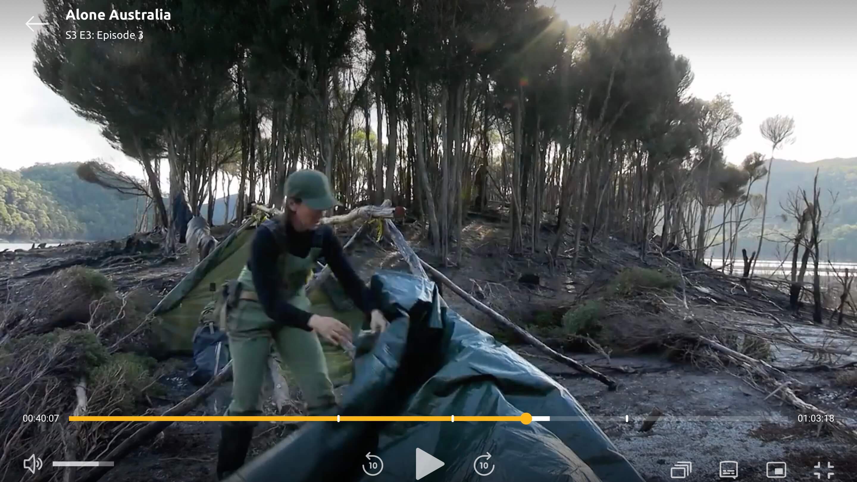
In episode three, Ceilidh walks alongside a creek in a fairly exposed area. While most viewers were probably fixated on her fish-trapping skills (I was too — those traps never work on Alone), I was in full screengrab-screengrab mode.
From the footage — and the position of the sun — I could tell the creek she caught the fish in flowed roughly north to south, emptying into a narrow arm of the lake heading in the same direction.
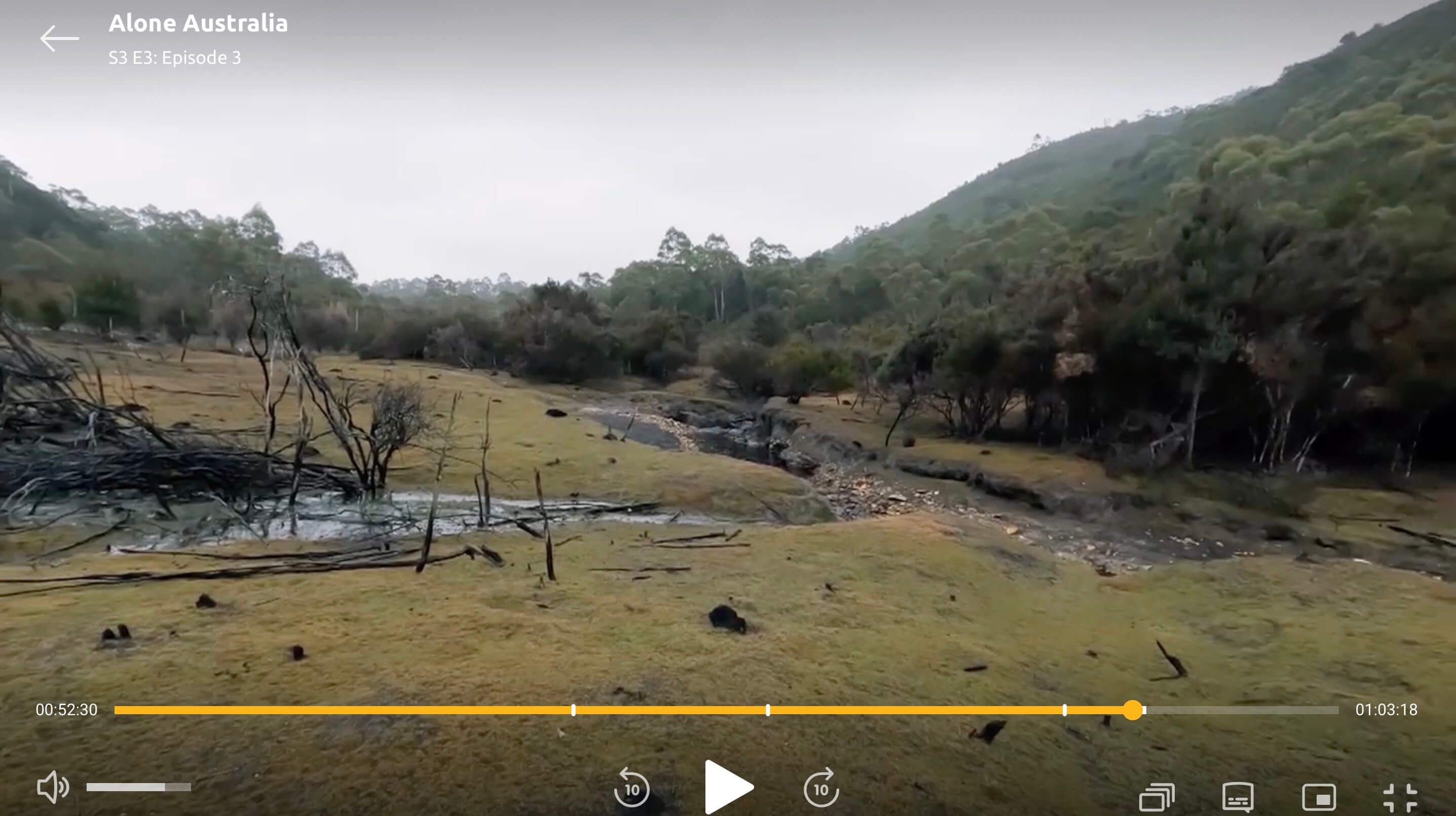
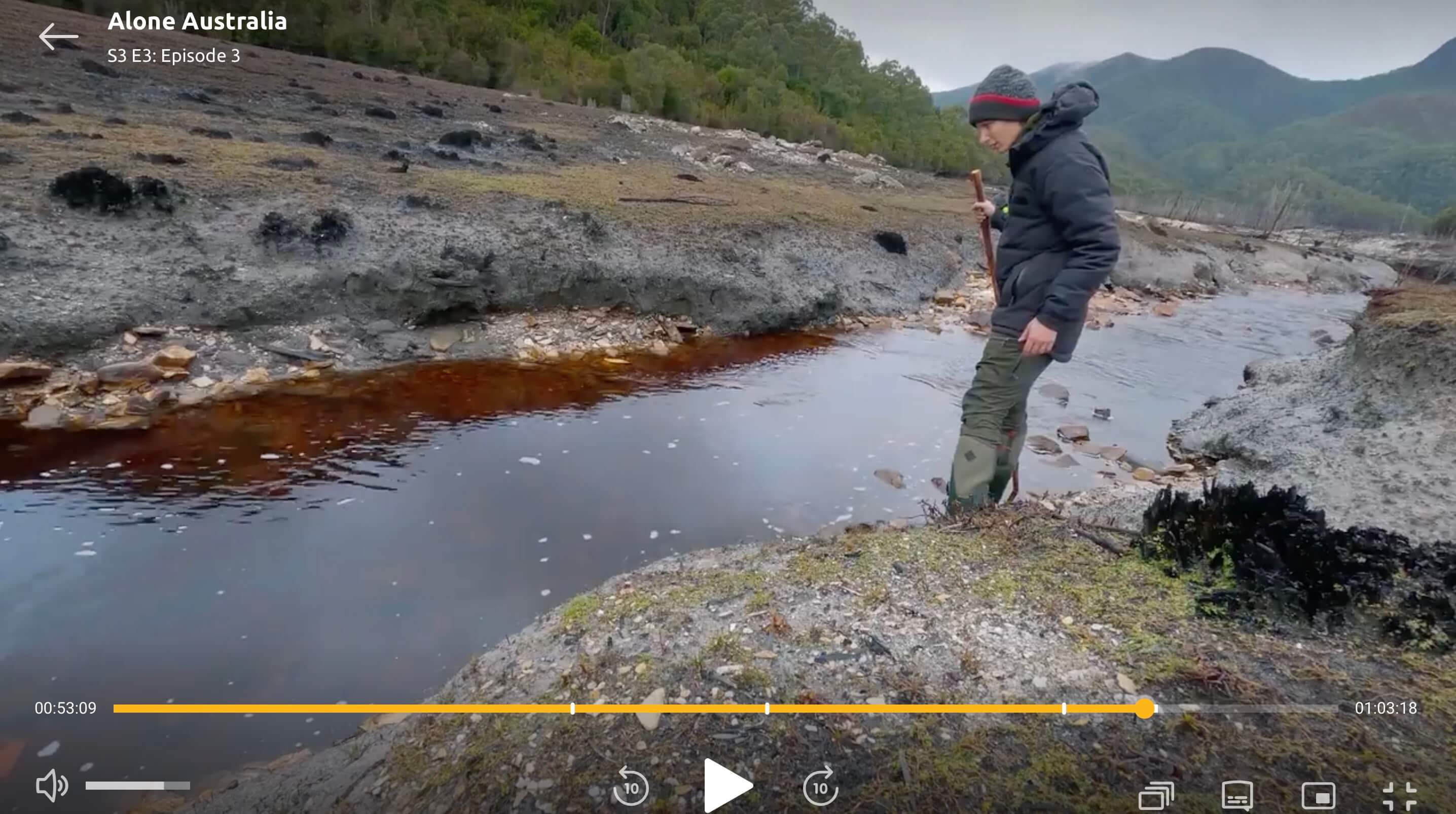
What really stood out was how open and grassy this location was — a rare sight in the otherwise dense forests around the lake. That narrowed things down a lot.
I was now looking for just a few specific features:
- A north–south arm of the lake
- A muddy flat at the northern end
- A creek flowing south into it, through open ground
By now, I’d spent enough time scanning aerial imagery to know: There were very few places that matched.
And there definitely wasn’t one in Lake Mackintosh.
It was time to let go of the kilometre infographics and return to Lake Burbury.
Using the high-resolution aerial photography from The LISTmap, I found it here — almost instantly.

It was a bittersweet moment. After hours of dead ends, I’d finally found it — but the location was only 14 km from Muzza as the crow flies.
The silver lining?
That confirmed it — both Muzza and Ceilidh were on Lake Burbury.
I now felt confident! All the contestants had to be somewhere on Lake Burbury which that narrowed things down A LOT!
But Surely the Distance Still Meant Something?
So how did 14 km become 49.7?
If I could figure that out, I thought I still had a shot at finding the other eight contestant locations.
So I used Google Maps’ measure tool and traced the shortest path a boat could take from Ceilidh’s location to the nearest boat ramp.
From there, I followed the winding roads around mountains, through Queenstown, and to a boat ramp closer to Muzza — then finally back across the lake to his location.
And… BINGO — it was about 50 km.
I was now convinced: the show’s distance graphics weren’t as-the-crow-flies, but were showing the actual travel path the production team might have taken by boat and road.
So I kept going — drawing more travel paths, testing other contestant pairs, looking for patterns that matched the distances on screen.
But… nothing ever lined up.
Eventually, I had to admit it: the distances were just unreliable.
So… I changed tack
At this point, I stopped chasing distances and started asking a new question:
“If I were the producers, where would I drop them?”
If all ten were on Lake Burbury, there were only so many spots that:
- Were accessible by boat,
- Were far from places like boat ramps and roads,
- And were isolated enough to prevent contestants from seeing or hearing each other.
So instead of matching terrain from footage, I flipped the approach: I scanned the map and compiled a shortlist of the most plausible drop zones.
Then I jumped into Google Earth’s 3D view, exploring each spot from ground level — rotating the view to match the hills, ridgelines, and angles visible in the show.

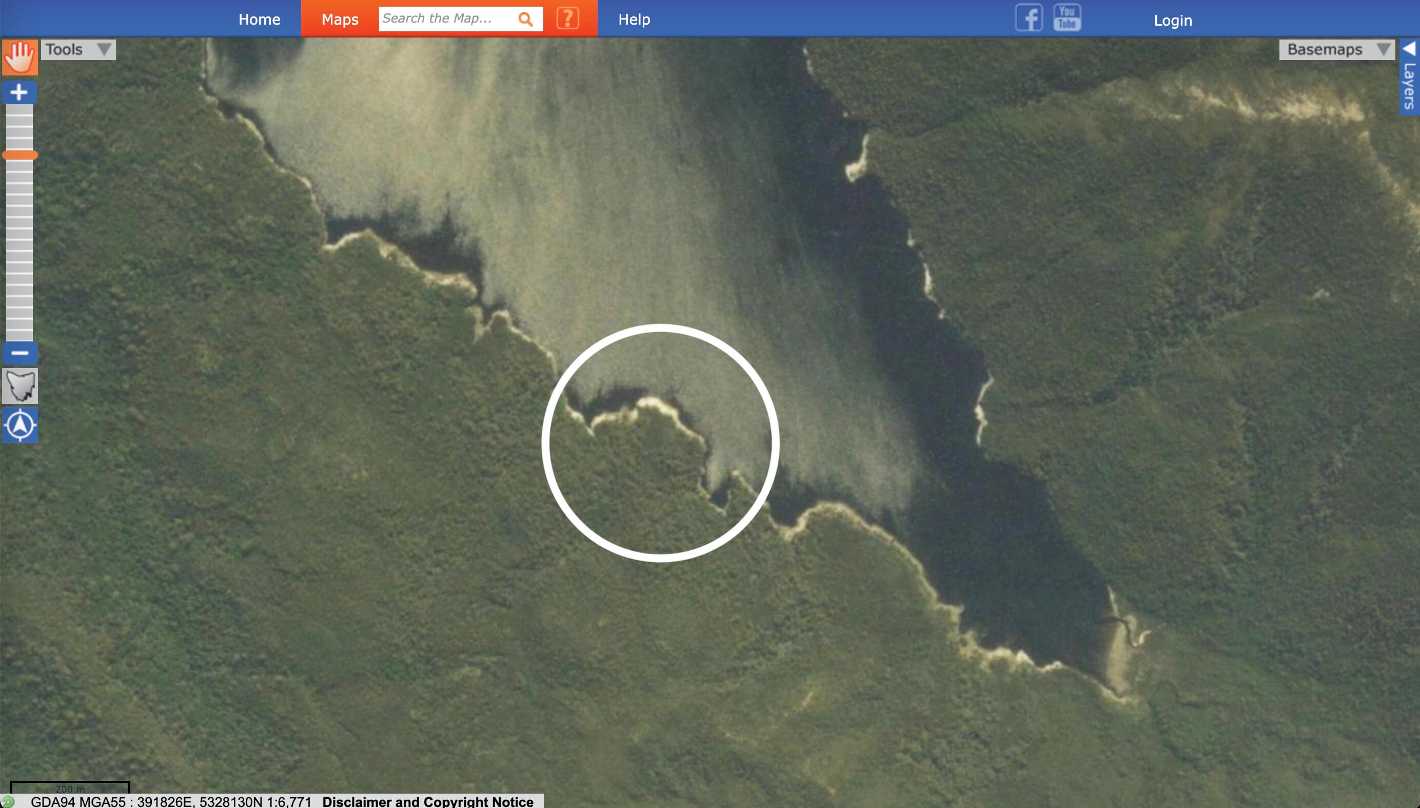
Finding Yonke with Mountain Silhouettes
By now I was pretty familiar with the silhouette shapes of the mountains from different angles. So while browsing through screengrabs from Yonke’s location, I instantly recognised Mt Owen in the background (I’ve also ridden the Mt Owen mountain bike trails — highly recommend!).
So I dropped into Google Earth’s 3D view, rotated the camera to match the angle from the footage… and YES.
Every bump, ridge, and hill matched.
With contour lines and satellite imagery to confirm it, I was able to pinpoint her exact location.
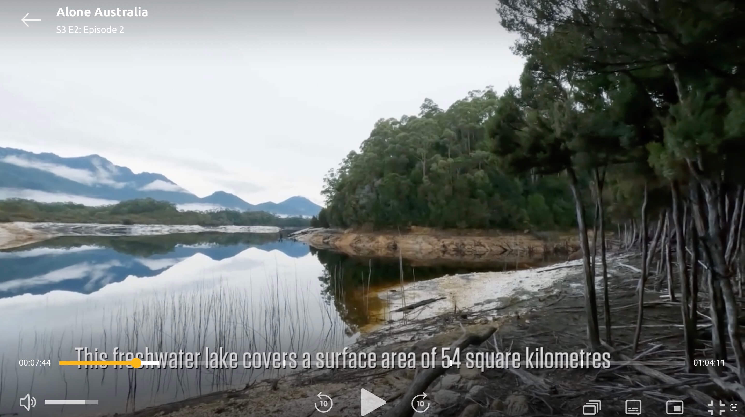
(Bonus fact: Wikipedia lists Lake Burbury as covering 54 square kilometres.)
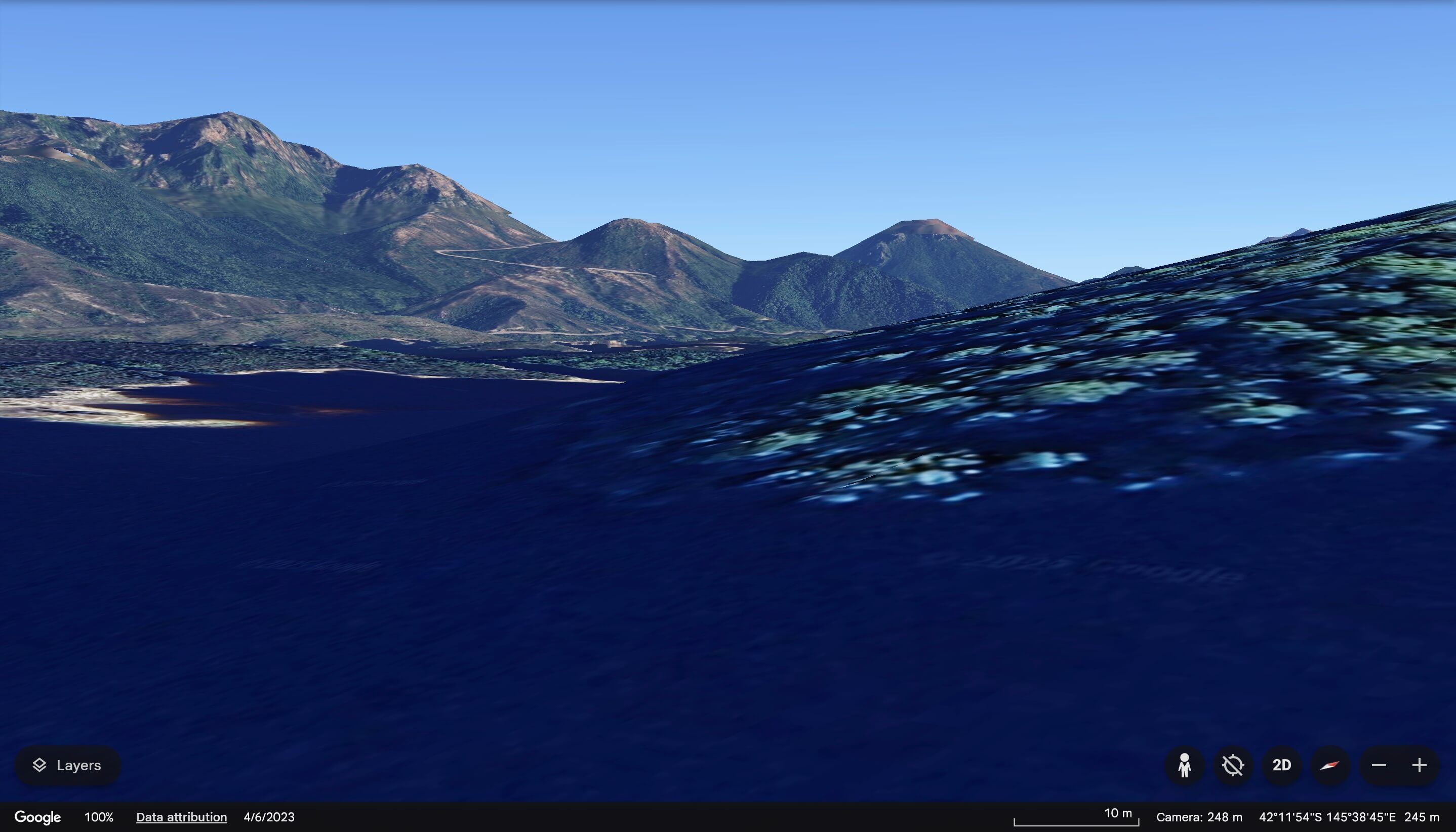
Note how the mountain shape is identical to the screengrab.
Three down — seven to go.
It was at this point I finally admitted that the “km away” infographics were wildly unreliable. I kept logging them as I watched, mostly out of curiosity — and while they gave a rough sense of distance (40–50 km meant “other end of the lake”, 5 km meant “close-ish”), that was about it.
Now I was on a roll
Once I let go of the distances and focused solely on my shortlist of likely campsites, things got a lot easier.
Using terrain clues and process of elimination, I was able to find the rest of the remaining contestants (except for Karla) relatively quickly. I don’t actually remember what order I found them in — I was too deep in the map zone by that point.

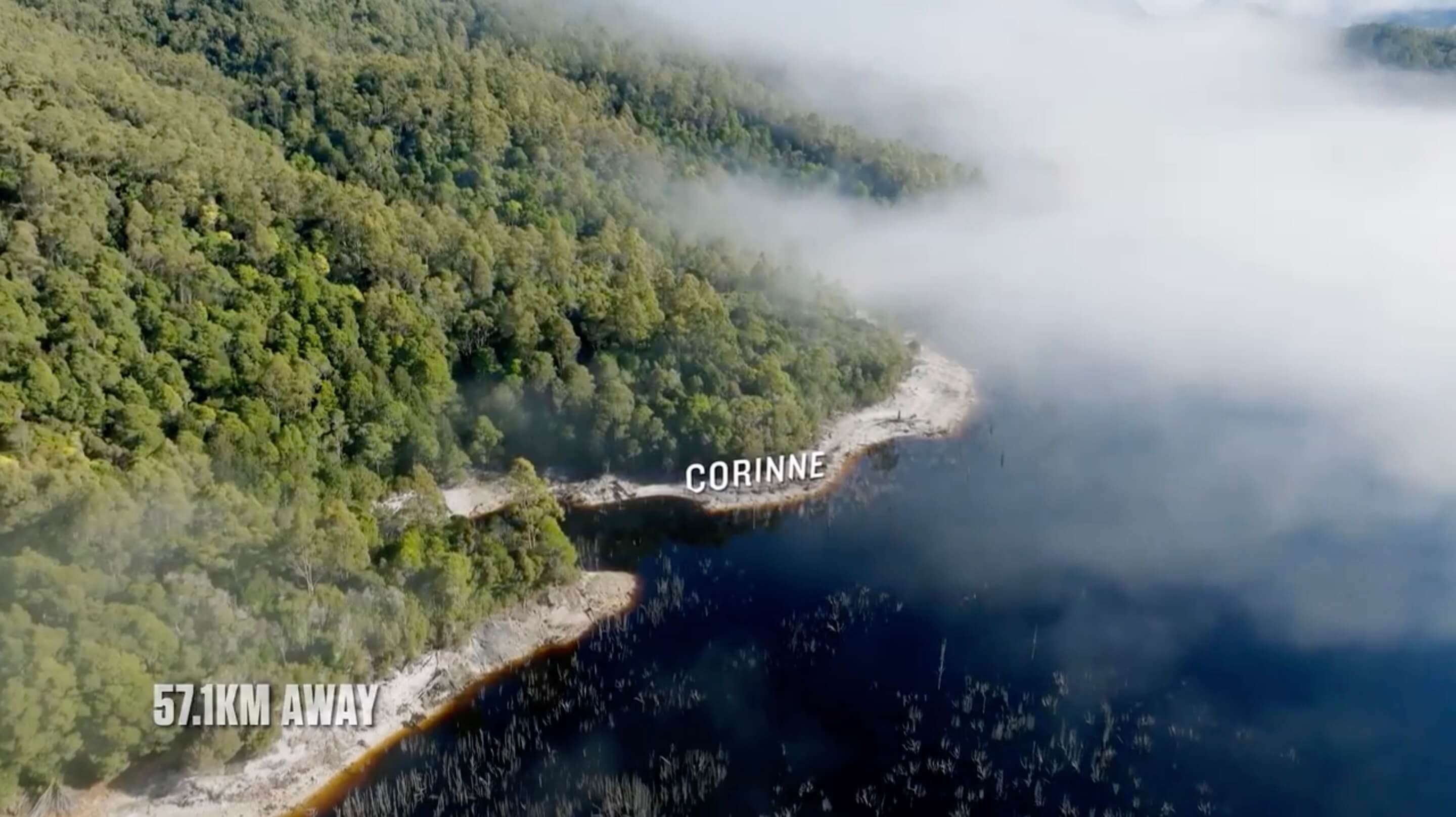
Corinne
The title graphic wasn’t much help — but once I noticed the sun angle and started comparing nearby hills, everything clicked.
I also matched those hills with contour lines.

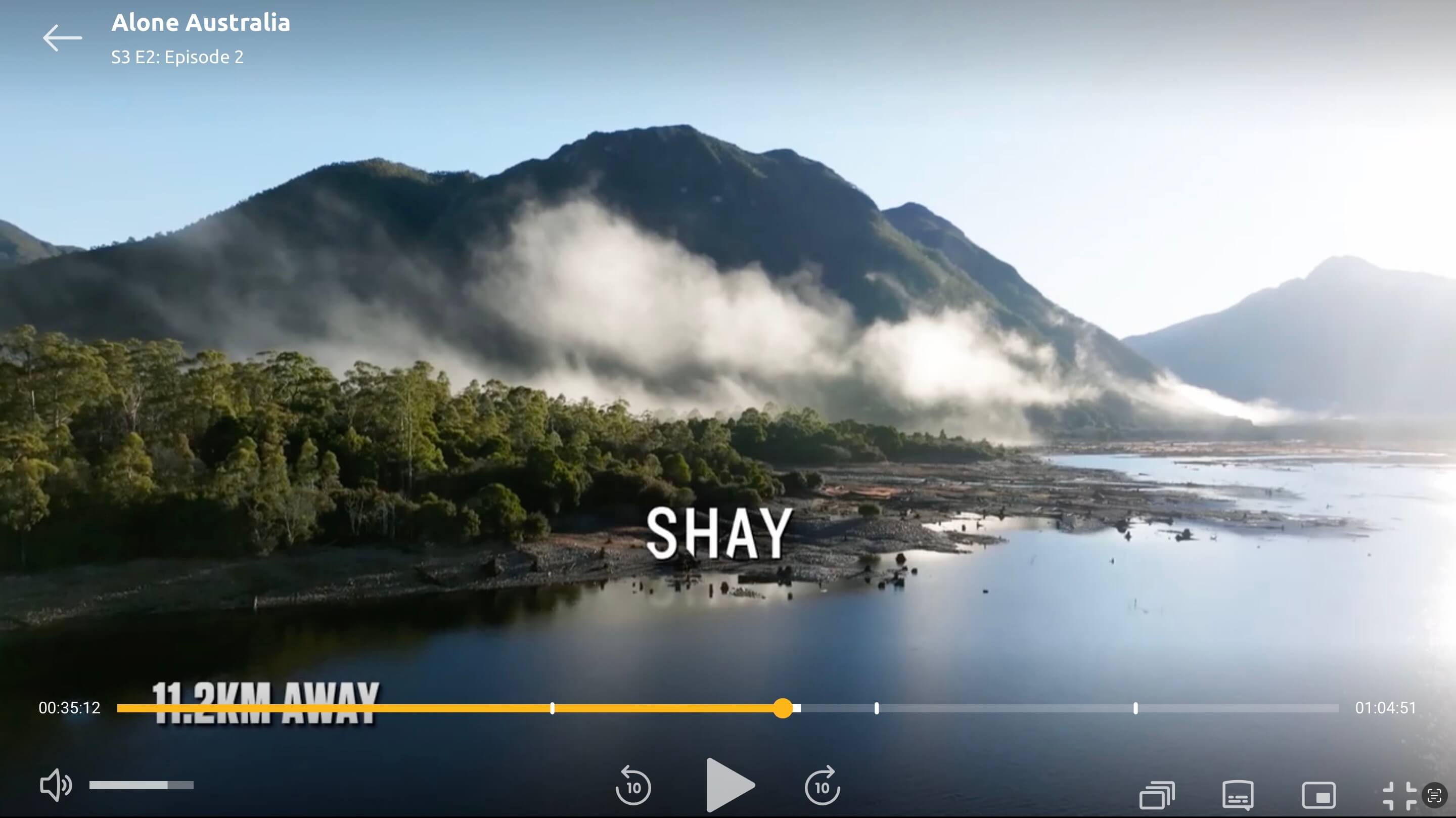
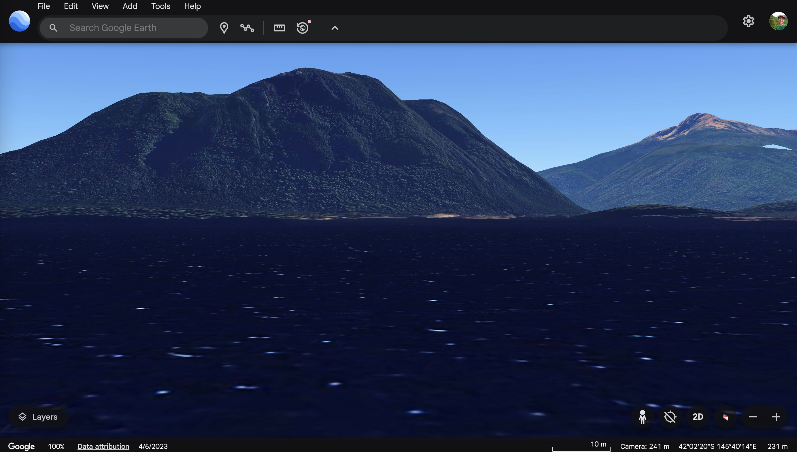
Shay
Just like with Muzza, it was clear from the start that Shay was at the northern end of Lake Burbury. But it was matching the mountain silhouette behind him in Google Earth that locked in the exact spot.

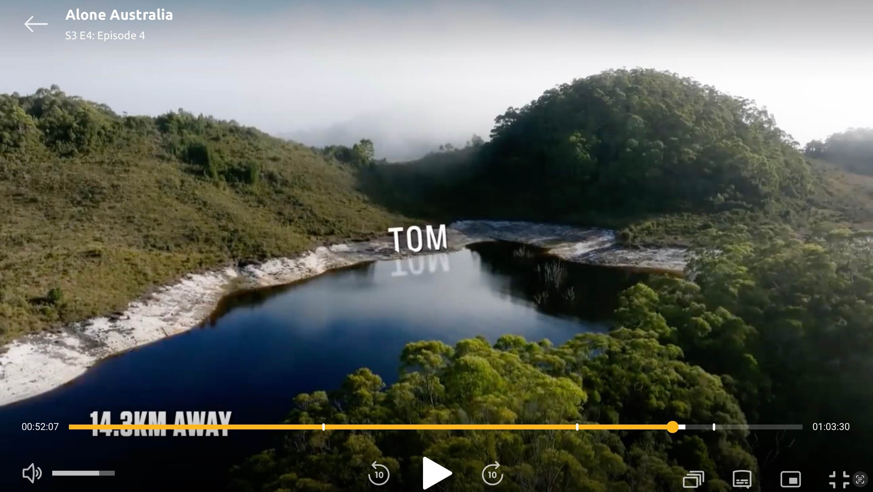
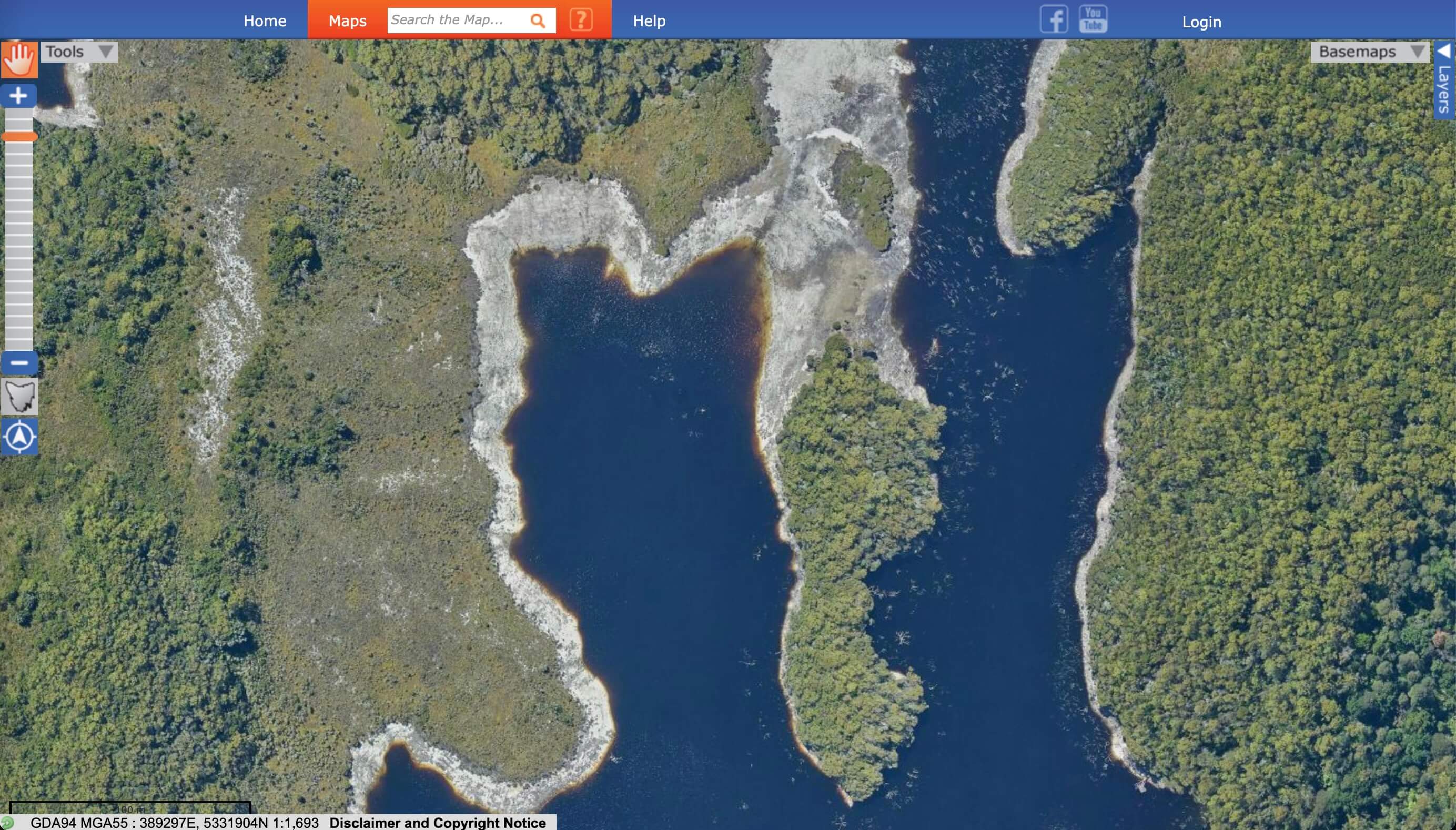
Tom
This secluded arm of the river was an obvious drop spot — but it still took me an embarrassingly long time to realise it was Tom’s.

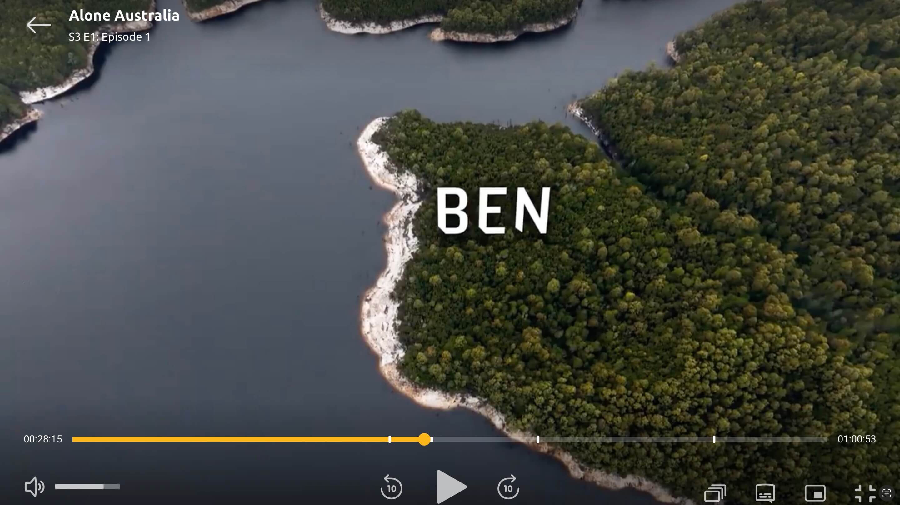
Ben
In hindsight? Super obvious. But I’d already convinced myself Karla must’ve been dropped further north — so I completely overlooked Ben’s spot.

Eva & Matt: Neighbours?
At one point, the show claimed that Eva and Matt were 6.2 km apart.

Turns out? They were just 750 metres from each other. (Yes. Metres. Not kilometres.)
Even if I’m being generous and measure the boat-accessible route, it still only comes out to about 1.4 km.
Can you spot the tiny island here in the title-card screengrabs below?
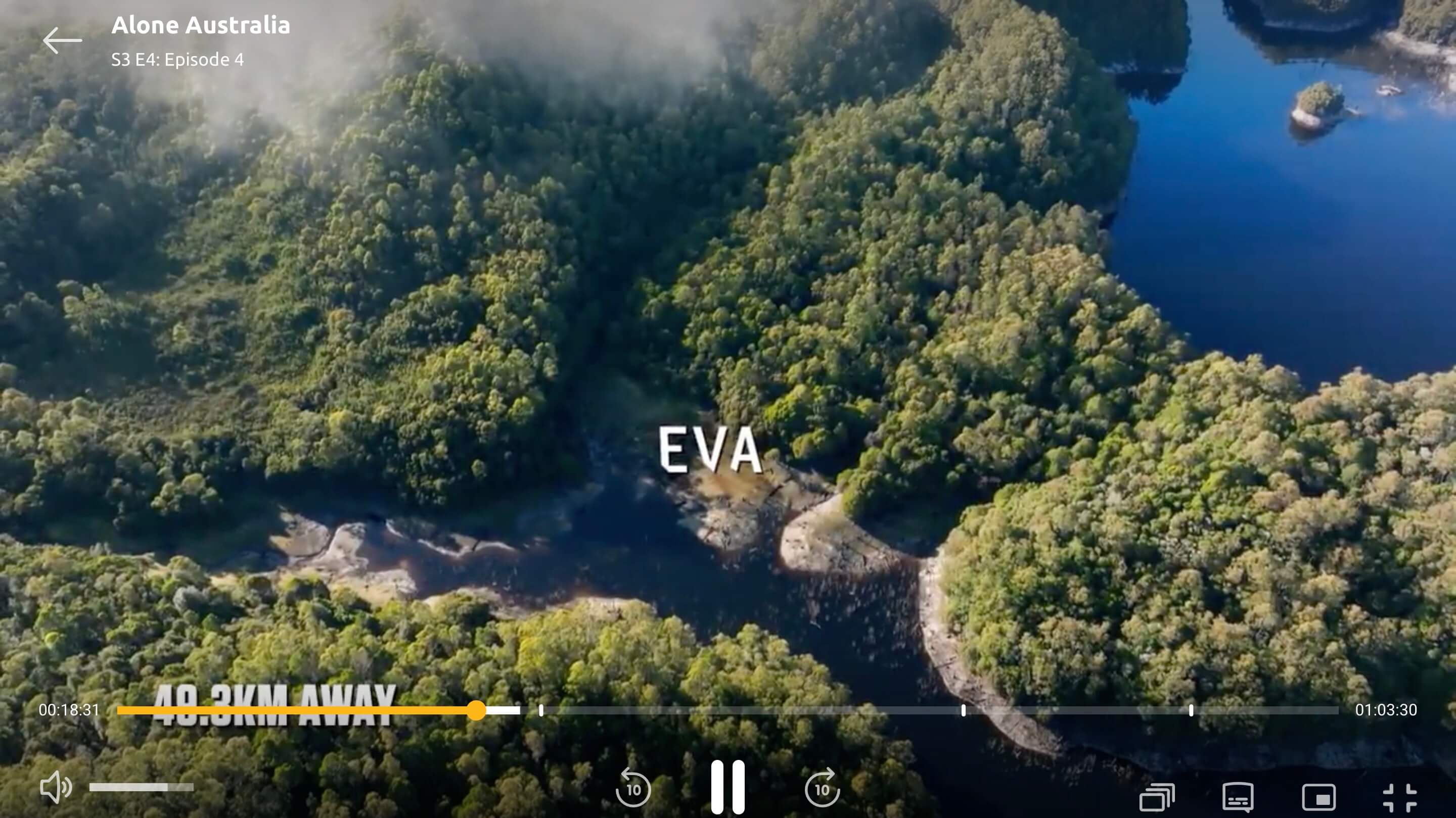
Take a close look. Can you spot where Matt’s camp would be in Eva’s title shot if the camera was tilted just a little further to the right?
(Hint: Track the island. You can’t miss it.)

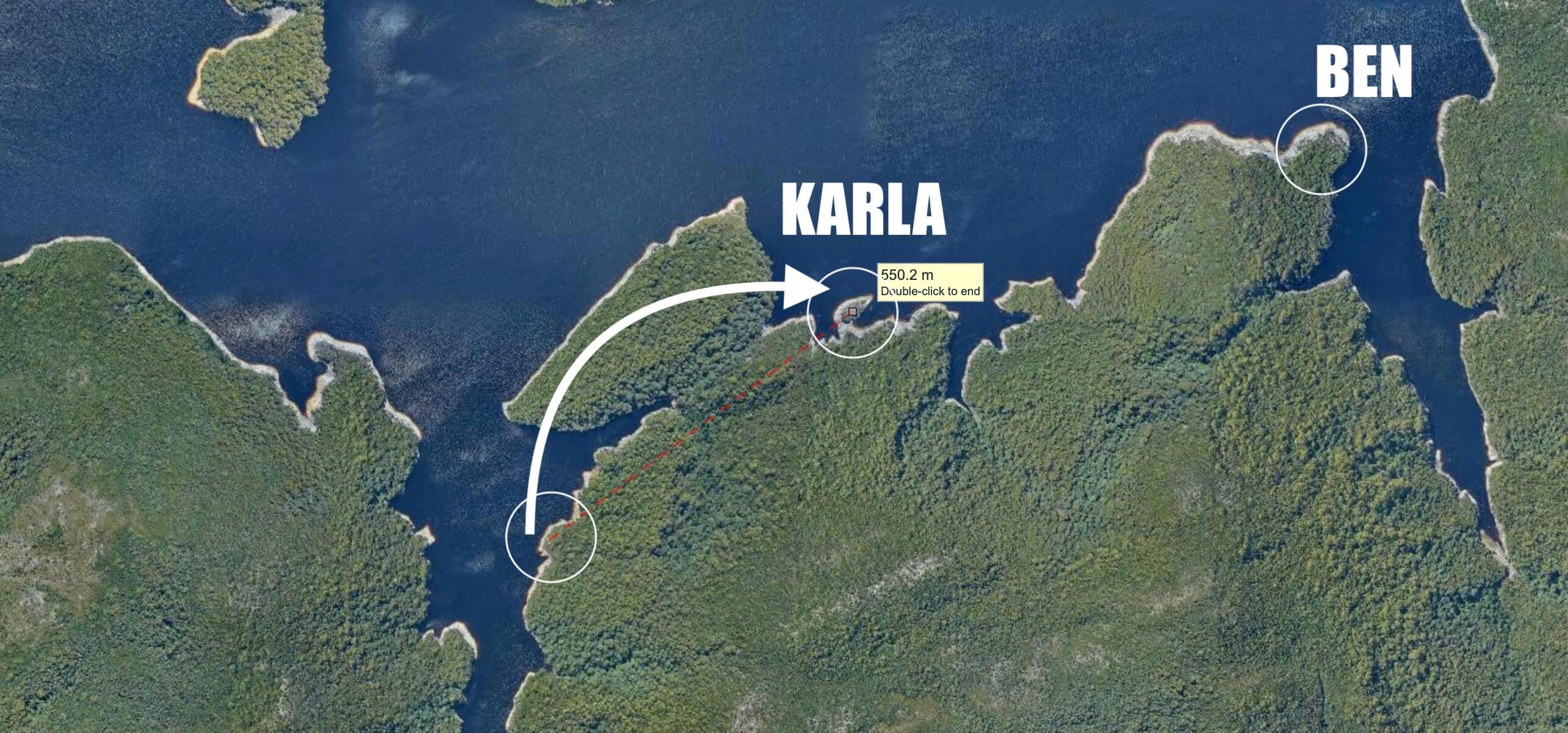
But Where the Heck Was Karla?
One contestant completely stumped me: Karla.
The show claimed she set up camp 1 km from where she was dropped — but we already know those distance graphics are… generously interpreted. (That said, this time it was surprisingly close.)
In early footage, she’s seen building her shelter under a distinctive patch of trees — almost like a little island. That visual stuck with me.
So I started scanning Lake Burbury again, looking for that clump of trees. Eventually, I found this promising match:
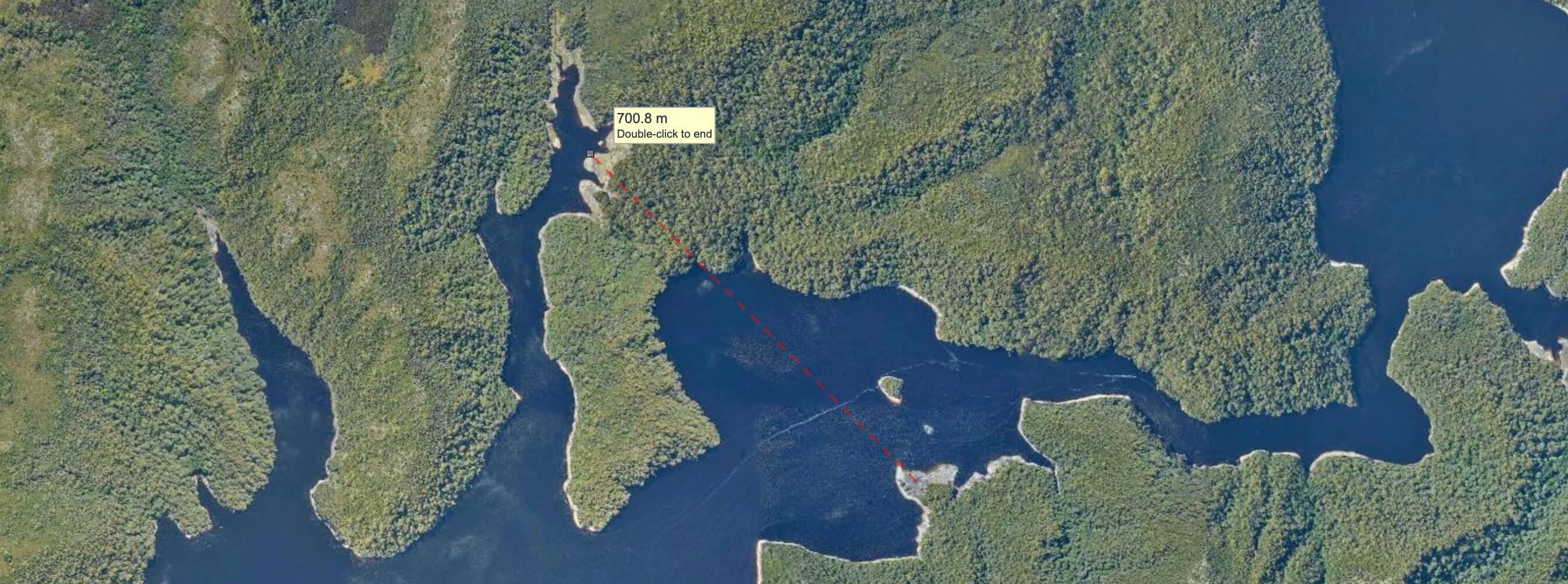
The “tree island” was such a close match that I locked in on that spot. I spent all my effort trying to find proof that this was her location, which meant I didn’t look in the obvious other places that it could have been.
Eventually, after way too many hours squinting at shoreline shapes and topographic contours… Bingo — I found her only 700 metres from Ben! I backtracked and quickly found the drop spot that matched her title infographics.
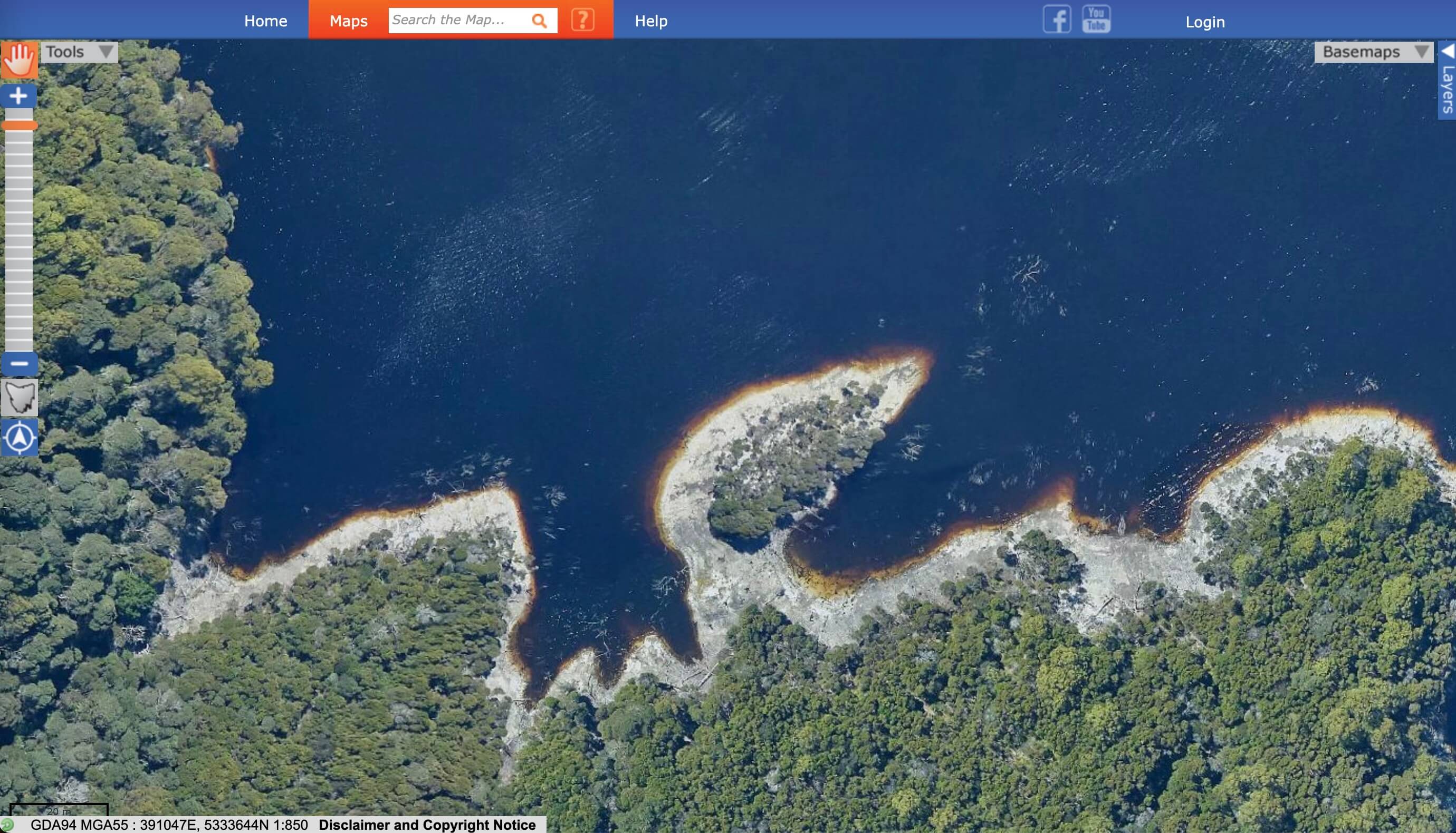
That Tree Island? It Flooded.
Spoiler: Skip this section if you haven’t seen episode 10
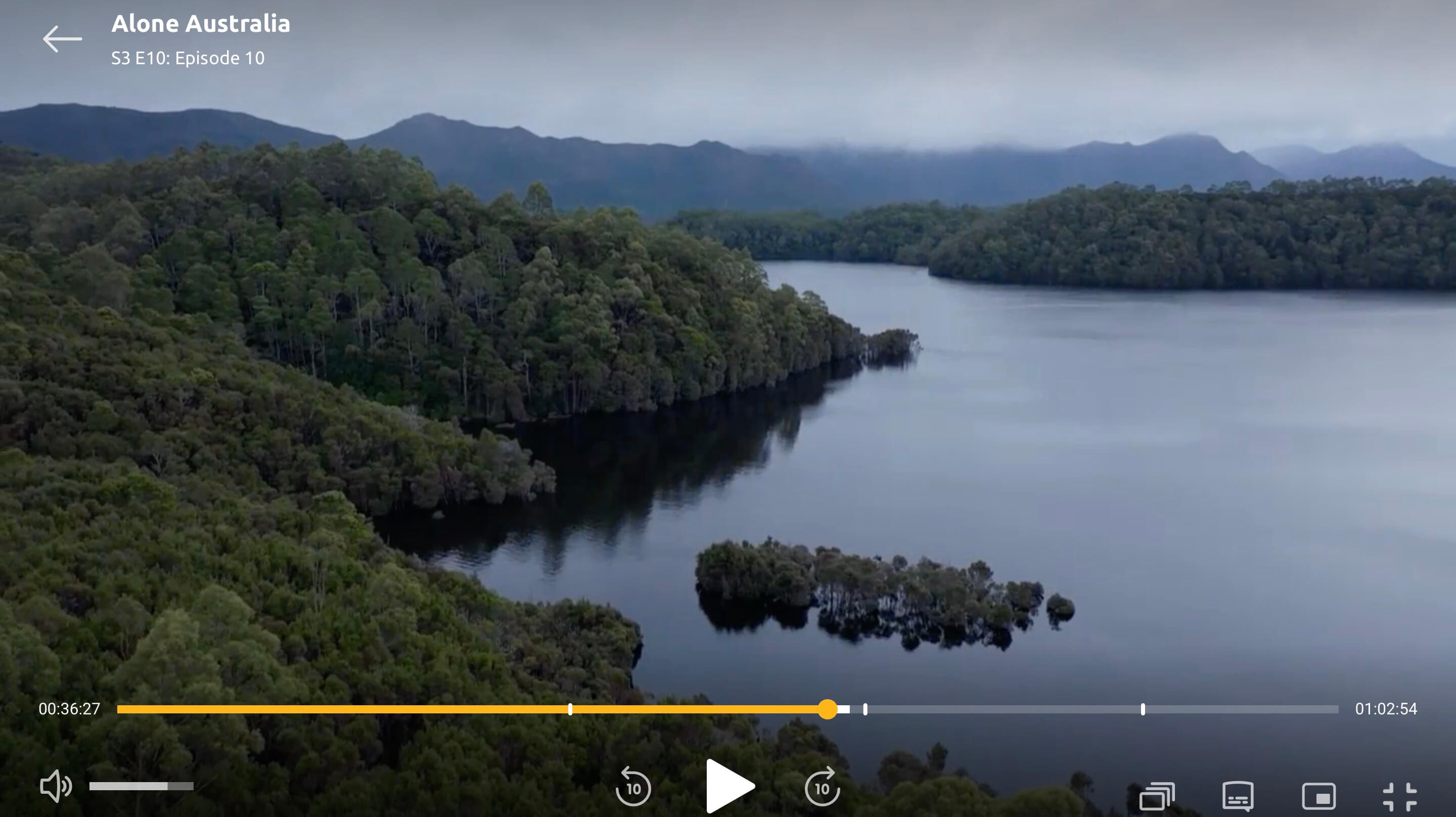
In Episode 10, the water level rises dramatically. While Karla had already tapped out, the editors included some amazing B-roll showing the spot where she camped — now completely underwater.
So were they really “Alone”?
YES — I THINK SO.
Sure, the distance infographics were sketchy at best.
But that doesn’t mean the experience wasn’t real.
Matt and Eva were only 750 metres apart —
but with a river, a steep hill, and thick bush between them.
And if the terrain was crossable? The producers could’ve just told Eva not to head that way.
In this part of Tasmania, it can take hours to push through just 100 metres of bush.
Ah, I get it now — the show must have been measuring distance in…
“Adjusted Bush Density Kilometres”!
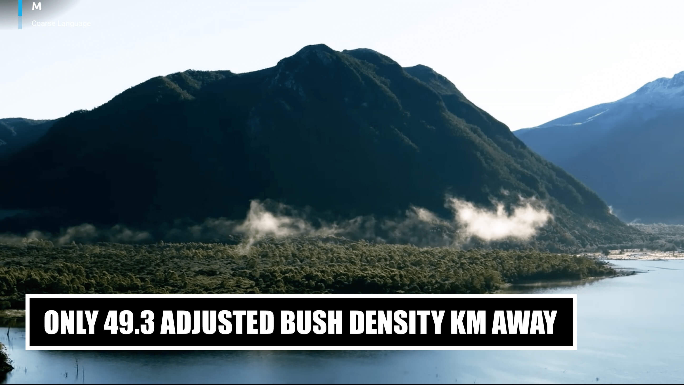
Okay, probably not. But it definitely felt like that.
So yes — the distances were fiction. But I believe the experience was authentic.
Just one last question…
Does all this mean I’m a geoguesser now? 🧐
And if you want the raw data here is it: